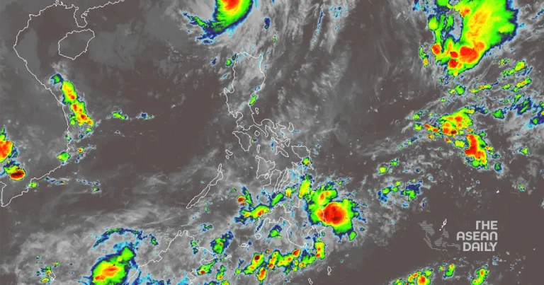
3-10-2024 (MANILA) Typhoon Julian (internationally known as Krathon) has re-entered the Philippine Area of Responsibility (PAR) on Thursday, mere days after its initial devastating impact on northern Luzon, according to the state weather bureau PAGASA.
The typhoon’s resurgence brings renewed concerns for the already battered regions of Batanes and Babuyan Islands. PAGASA warns that Julian’s trough or extension will usher in cloudy skies accompanied by scattered rains and thunderstorms across these areas.
Benison Estareja, a weather specialist at PAGASA, reports that Julian is currently wreaking havoc with heavy rains in Taiwan, where it is expected to make landfall later today. However, there’s a glimmer of hope as Estareja predicts the typhoon might recurve and weaken into a low-pressure area by Friday.
The typhoon’s initial pass through the Philippines earlier this week left a trail of destruction in its wake. Batanes bore the brunt of Julian’s fury, with reports of widespread power and communication outages, and extensive damage to residential structures, according to local authorities.
The National Disaster Risk Reduction and Management Council (NDRRMC) provided a sobering update on Wednesday, confirming eight injuries and one person missing due to the typhoon. The council also reported that 5,431 individuals have been displaced, primarily from the Ilocos and Cagayan Valley regions in the country’s north.
While Julian dominates the weather patterns in the north, the southern regions of the Philippines are not spared from inclement weather. PAGASA forecasts that Davao Region, Soccsksargen, and Caraga will experience cloudy skies with scattered rains and thunderstorms due to easterlies – warm winds originating from the Pacific.
For the capital region of Metro Manila and the rest of the country, the weather bureau predicts partly cloudy to cloudy skies interspersed with isolated rain showers or thunderstorms.


