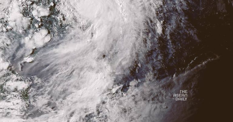
30-7-2023 (MANILA) The Philippine Atmospheric, Geophysical and Astronomical Services Administration (Pagasa) issued a warning for heavy rains, floods, and landslides in mountainous areas of the country as severe tropical storm Khanun is forecast to develop into a typhoon. Khanun is expected to “steadily intensify within the next three days,” according to Pagasa’s 5 am advisory. The storm is forecast to become a typhoon between late evening on Sunday or early morning on Monday and reach its peak intensity on Tuesday.
Although Khanun’s path is northward over the Philippine Sea and appears to be heading away from landmass, the weather bureau warned of heavy rainfall, with the storm and super typhoon Doksuri, which hit the country last week, boosting the Southwest Monsoon. This will bring “occasional” monsoon showers over the western parts of Luzon and the Visayas, Pagasa added.
The Marikina River’s water level in the capital region reached 16.1 meters on Saturday evening, nearing the 18m level that triggers a forced evacuation of certain parts of Marikina City, according to the Philippine Daily Inquirer, citing the local government.
The Philippines is hit by an average of 20 tropical cyclones a year, making it one of the world’s worst-hit countries, according to Pagasa. Doksuri, which struck last week, destroyed more than 1.3 billion pesos worth of agricultural crops and caused an estimated 2.66 billion pesos of damage to infrastructure, including bridges and roads, according to local media reports citing the agriculture and public works departments. The super typhoon affected half a million people, mostly in the northern parts of main Luzon Island, and left 14 dead, according to the National Disaster Risk Reduction and Management Council. It also flooded more than 258 villages in the Luzon provinces of Bulacan and Pampanga, located north of Manila.
Khanun is moving at 15kph with maximum sustained winds of 95kph near the centre and gusts of up to 115kph, Pagasa said. The tropical storm may exit the Philippines Monday evening or early Tuesday before turning west-northwestward and passing close to Japan’s Okinawa Islands in the Ryukyu Archipelago on Tuesday morning and then entering the East China Sea.


