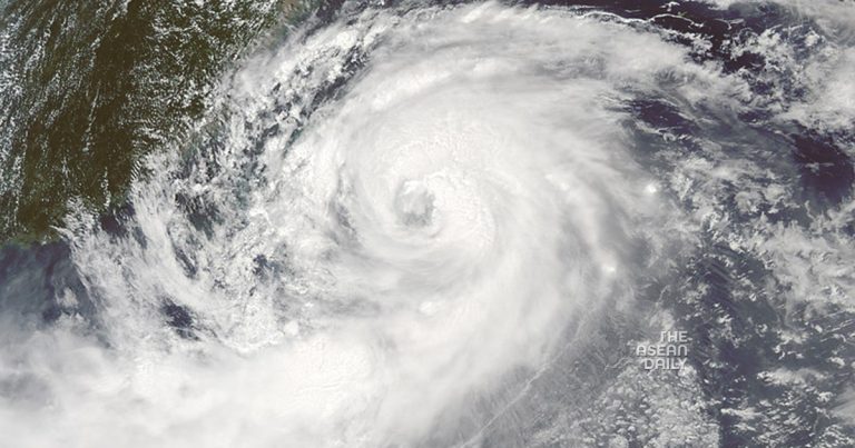
31-8-2023 (BEIJING) China’s National Meteorological Center has issued the highest typhoon warning as Typhoon Saola steadily approaches the southeastern coastline, posing a threat to Hong Kong and major manufacturing hubs in Guangdong province. At 6 am today, Chinese forecasters issued a typhoon red warning. Saola is currently situated approximately 295km southeast of Guangdong province and is projected to move northwest across the South China Sea at a speed of about 10km/h. Gradually nearing the coast of Guangdong, the typhoon is expected to weaken in intensity.
As of 9 am, wind speeds were recorded at 209 km/h. The National Meteorological Center predicts that Saola will make landfall along the coast, somewhere between Huilai County in Guangdong and Hong Kong, from the afternoon to the night of September 1.
In response to the approaching typhoon, China Railway has suspended several major train lines, and Shanghai has halted trains heading towards Guangdong, according to local media reports.
As Saola edges closer to Guangdong, the Hong Kong Observatory forecasts that winds over the region will gradually strengthen. They anticipate raising their strong wind Signal to No. 3, the second-lowest level, later today. Additionally, Saola is expected to bring storm surges to coastal low-lying areas. The Hong Kong Observatory estimates that Saola is currently approximately 440km away from the metropolis.
The Hong Kong Observatory also warns of heavy rainfall in parts of Fujian and areas of Guangdong until 8 am on Friday. Some regions may experience downpours ranging from 100mm to 220mm.
Saola’s impact is not limited to Guangdong province; it is also affecting Fujian province. Videos circulating on social media depict waves crashing along the coastline. The meteorological administration of Shishi City in Fujian has issued a typhoon blue warning.
In related news, Typhoon Saola has weakened as it approaches Taiwan, and hundreds of people have been forced to flee floods as the super typhoon brushes past the Philippines.


