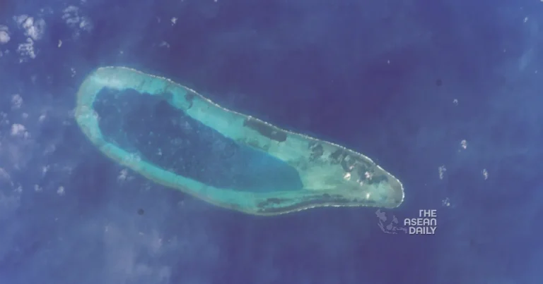
20-9-2023 (BEIJING) China has reportedly constructed two ground stations for its BeiDou satellite system on reefs in the disputed South China Sea, according to state television. The stations, located on North Reef and Bombay Reef in the Paracel Islands, are equipped with China’s land-based ship automatic identification system (AIS). This move has raised concerns as the Paracel Islands are also claimed by Vietnam and Taipei.
The newly established ground stations utilize the BeiDou satellite network, which was completed in 2020 as a rival to the US global positioning system (GPS). They enable the tracking and transmission of signals from vessels in the area, as mandated by China’s maritime administration. All ships within China’s jurisdiction are required to have an AIS transponder and keep the signal on at all times, facilitating identification and tracking by authorities and other vessels.
According to a report from state broadcaster CCTV on Tuesday, the two ground stations commenced operations on Friday and aim to address the “blind spot” in China’s shore-based ship AIS coverage in the waters surrounding the Paracel Islands. The Maritime Safety Administration stated that the stations would provide essential support for monitoring ships in the area, contributing to the ecological protection of the islands and reefs of Sansha, as well as offering safer and more reliable navigational guidance in the South China Sea.
Sansha refers to the municipality established by Beijing in 2012 to govern a significant portion of the South China Sea, encompassing the Paracel and Spratly Islands, as well as Macclesfield Bank. These areas fall within China’s controversial “nine-dash line” claim. However, the Philippines, Vietnam, Malaysia, Brunei, and Taipei also assert overlapping claims to parts of the resource-rich South China Sea, which is one of the busiest waterways globally.
China’s placement of the new ground stations on North Reef and Bombay Reef, situated in the northernmost and southeast regions of the Paracel Islands respectively, has strategic significance. The stations are positioned between various sensitive Chinese installations, including the headquarters of Sansha and several artificial islands housing naval and airbases. This area frequently experiences confrontations between the People’s Liberation Army and the US Navy during US “freedom of navigation operations” in the region.
Although BeiDou, like GPS, does not require ground stations for general navigation or positioning services, the presence of nearby ground stations can significantly enhance accuracy, particularly for military applications.


